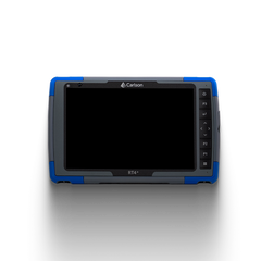
Carlson CADNet is a powerful, versatile software solution designed to convert and import PDF, raster, and vector data into CAD drawings, making it ideal for construction, engineering, and surveying professionals. Carlson CADNet simplifies the process of extracting accurate data from plans, maps, and aerial images, enabling users to create precise CAD models and enhance project workflows.
Key Features of Carlson CADNet Software:
-
Efficient PDF and Image Conversion: Carlson CADNet allows users to quickly convert PDF files, scanned images, and other raster data into CAD-ready formats. This feature enables seamless integration of legacy documents, making it easy to incorporate historical plans and aerial images into current projects.
-
Vectorization of Scanned Data: With advanced vectorization tools, Carlson CADNet can transform scanned documents, such as engineering drawings or topographic maps, into editable vector formats. This allows users to trace lines, arcs, polylines, and other shapes with accuracy, enhancing detail and precision in CAD projects.
-
Contour and Elevation Extraction: Carlson CADNet is equipped to extract elevation data from contour maps and images, enabling users to create accurate terrain models. This is ideal for site planning, grading, and other applications that require precise elevation information.
-
Seamless Integration with Carlson Software Suite: Carlson CADNet integrates smoothly with Carlson Civil, Carlson Survey, and other Carlson products, allowing for easy data sharing across various project stages. This compatibility optimizes project workflows and improves productivity.
-
Flexible Import and Export Options: Carlson CADNet supports a wide range of file formats, including DWG, DXF, and various image formats, providing flexibility in how data is imported and exported. This allows users to work with multiple data sources and create CAD models that meet industry standards.
-
Enhanced CAD Editing Tools: Carlson CADNet offers a suite of editing tools that enable users to refine and manipulate imported data directly within the software, making it easy to edit shapes, lines, and text for CAD-ready files.
No data added.
- N/A
- N/A
- Unopened and unused items may be returned within 15 days of purchase for a full refund.
- A 10% to 20% restocking fee will apply after 15 days.
- Returns must be accompanied by the original proof of purchase from James River Laser.
- To learn more, visit the Return and Replacement Policy Page (Link).
- If your order arrives damaged, please notify us within 48 hours of receipt.
- Defective or damaged items may be replaced for the same product within 15 days of purchase.
- Replacements are subject to product availability.
- Offering a wide range of construction lasers, survey equipment, machine control systems, GPS systems, trench shoring, and more from top names in the industry.
- Backing our equipment with manufacturer warranties.
- Offering a customer-friendly return policy with flexible options.
- Ensuring your confidence in our products through replacement policies for defective or damaged items.
- Putting you first by resolving shipping-related issues promptly.
Related Products
- Choosing a selection results in a full page refresh.


 Liquid error (snippets/slide line 49): invalid url input
Liquid error (snippets/slide line 60): invalid url input


