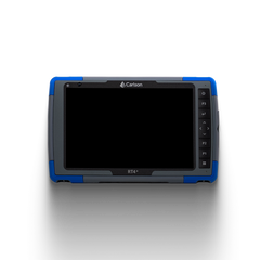
Carlson Point Cloud is a powerful software solution designed for professionals who work with 3D point cloud data. Ideal for surveyors, civil engineers, and construction professionals, this software transforms raw point cloud data into actionable insights, supporting tasks such as topographic mapping, surface modeling, and as-built documentation. With its ability to import, analyze, and model high-resolution data, Carlson Point Cloud enhances project accuracy and efficiency, making it a must-have for projects involving LiDAR, UAV scans, and laser-scanning data.
Carlson Point Cloud – Basic Version: The Basic version of Carlson Point Cloud is designed for users who need essential point cloud processing tools. This version offers:
- Basic Point Cloud Import and Visualization: Easily import and view point cloud data for various applications, supporting popular formats like LAS, PTS, and E57.
- Essential Data Processing: Perform tasks like data filtering, thinning, and slicing to clean and refine your point cloud data for straightforward projects.
- 3D Visualization and Basic Modeling: Visualize data in 3D and create basic models to understand terrain and structure layouts, ideal for surveyors working on simpler site analysis.
Carlson Point Cloud – Advanced Version: The Advanced version of Carlson Point Cloud expands on the capabilities of the Basic version, making it suitable for users with more demanding requirements. Key features include:
- Enhanced Surface Modeling: Build highly accurate, detailed surface models directly from point cloud data, ideal for complex terrains and topographic projects.
- Automated Feature Extraction: Automatically identify and extract features like breaklines, boundaries, and ground points, speeding up data processing and improving accuracy.
- Advanced Measurement and Analysis: Gain access to tools for precise volume calculations, contour mapping, and cross-section analysis, essential for construction and earthworks.
- Seamless Integration with Carlson CAD: Enjoy direct integration with Carlson’s CAD software for a smooth workflow from point cloud to CAD drawings, perfect for detailed site planning.
No data added.
- N/A
- N/A
- Unopened and unused items may be returned within 15 days of purchase for a full refund.
- A 10% to 20% restocking fee will apply after 15 days.
- Returns must be accompanied by the original proof of purchase from James River Laser.
- To learn more, visit the Return and Replacement Policy Page (Link).
- If your order arrives damaged, please notify us within 48 hours of receipt.
- Defective or damaged items may be replaced for the same product within 15 days of purchase.
- Replacements are subject to product availability.
- Offering a wide range of construction lasers, survey equipment, machine control systems, GPS systems, trench shoring, and more from top names in the industry.
- Backing our equipment with manufacturer warranties.
- Offering a customer-friendly return policy with flexible options.
- Ensuring your confidence in our products through replacement policies for defective or damaged items.
- Putting you first by resolving shipping-related issues promptly.
Related Products
- Choosing a selection results in a full page refresh.


 Liquid error (snippets/slide line 49): invalid url input
Liquid error (snippets/slide line 60): invalid url input


