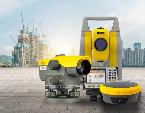
Any successful civil engineering project must have surveying as the foundation. It provides precise measurements and gathers essential information on the terrain, borders, and current features of a site. Subsequently, this data is utilized for project design, construction scheduling, and regulatory compliance assurance. Both beginners and experienced professionals in civil engineering must select the appropriate civil survey equipment and tools.
This guide provides an overview of essential survey equipment used in civil engineering projects. We will examine both contemporary and conventional technologies, emphasizing their uses and selection factors. Civil engineers are better equipped to choose the right survey tool for their particular project requirements and budget by being aware of each tool's capabilities.
Traditional Ground Survey Tools
While advancements in technology have introduced innovative surveying techniques, traditional ground survey methods remain the basis of civil engineering projects. These methods utilize a variety of tools, categorized here for better understanding:
Measuring Tools:
Measuring tapes and chains:
These workhorses of the surveying world provide direct measurements of horizontal distances. However, their limitations include susceptibility to temperature variations and the potential for human error during long measurements.
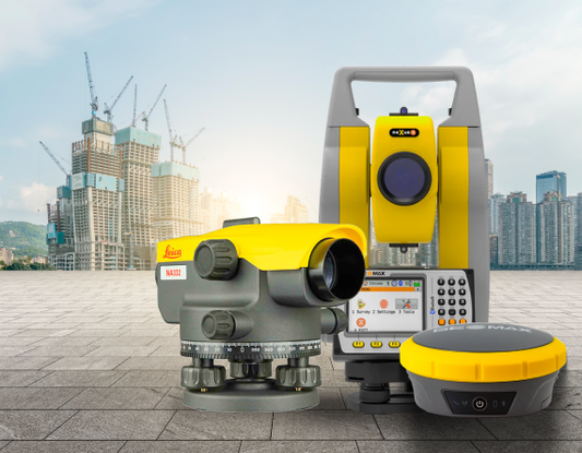
Total Stations:
This advanced instrument combines the functionalities of a theodolite with an electronic distance meter (EDM). Total stations electronically measure horizontal and vertical distances with exceptional accuracy, significantly improving efficiency compared to manual taping.
Angular Measurement Tools:
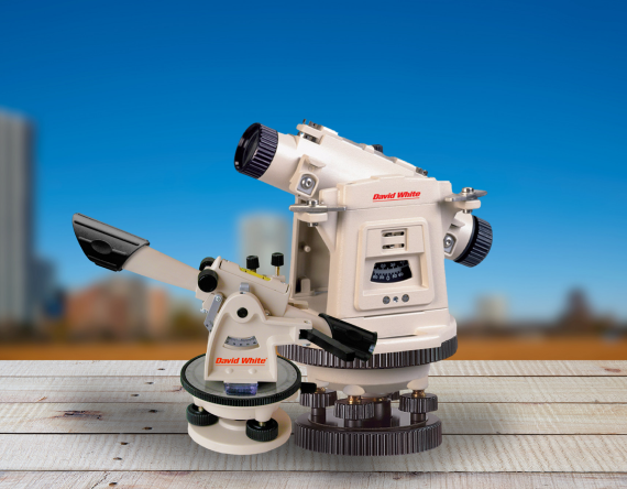
Transits and Theodolites:
These traditional surveying tools provide extremely accurate measurements of both horizontal and vertical angles. For this, they use graduated scales to compute angles and align their sights with objects of interest. Total stations are gradually replacing transits and theodolites for civil engineers because transits and theodolites are still widely used in other areas of construction.
Other Essential Tools:
Prisms and Reflectors:
These specialized components operate in conjunction with total stations. At a specific location, a prism is affixed to a staff and reflects the laser beam of the entire station, thereby enabling the precise measurement of distance.
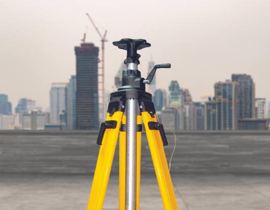
Tripods and Staffs:
Accurate measurements necessitate stable platforms. Prisms or targets are held at specific locations on the survey site by staff, while tripods provide a stable foundation for total stations and levels.
Plumb Bobs:
The use of gravity to establish a vertical reference is what makes plumb bobs such a useful tool. Surveyors can guarantee that their instruments and measurements are precisely aligned with gravity by suspending a weight on a string.
Surveying Magnetic Locators:
They are typically used to locate survey pins, buried manhole covers, water shutoff valve covers, and other landmarks that are important for surveying.
Modern Surveying Technologies
This section explores two key advancements: Global Navigation Satellite Systems (GNSS) and Real-Time Kinematic (RTK) for real-time positioning, alongside data collection and processing practices.
Global Navigation Satellite Systems (GNSS) and Real-Time Kinematic (RTK):
The term "GNSS" describes a group of satellites that orbit the planet and provide exact location information. GNSS receivers are used by civil engineers to pinpoint their exact placement on the ground. In contrast to traditional approaches that depend on line-of-sight or triangulation, GNSS provides many benefits. It takes less time, can function in most weather situations, and effectively covers large areas. However, variables like satellite geometry and atmospheric conditions might affect GNSS accuracy. Real-Time Kinematic (RTK) technology can help with this. Real-time corrections to the raw GNSS data received by the rover unit on the ground are made possible by RTK, which makes use of a network of fixed reference stations with established positions. As a result, point positioning accuracy is greatly increased, usually reaching centimeter-level precision. RTK has many advantages for civil engineering projects. It makes data collection quicker and more effective, especially for large-scale surveys.
Data Collection and Processing
GNSS and RTK are only two aspects of modern surveying's efficiency. Data collectors are used to record digital images, field notes, and GNSS data alongside survey sites. They are essentially ruggedized tablet PCs. These gadgets allow for real-time data sharing and display by integrating smoothly with surveying software.
Software for surveys is yet another essential part of the contemporary workflow. It makes it possible to process and analyze gathered data to produce deliverables like digital maps and landscape models. To guarantee the accuracy of the finished output, the software may also carry out intricate calculations and modifications.
However, the importance of proper data management cannot be overstated. Sustaining data integrity during the surveying process requires using dependable software and putting in place strong data-gathering practices. This guarantees that civil engineers may make sound choices based on trustworthy information and can have faith in the precision of their measurements.
Your civil engineering project's success requires an investment in appropriate survey instruments. Precise information contributes to effective project management, reduces expensive mistakes, and guarantees timely and cost-effective project completion. For the latest and most reliable survey equipment solutions, look no further than James River Laser. Contact us today to discuss your project needs and explore how our comprehensive selection of civil survey equipment can empower your team to achieve exceptional results.


