Accurate surveying requires different specialized equipment, each with its advantages and applications. As you go through this guide, we'll go over the unique features and uses of various survey equipment, giving you the understanding you need to choose wisely for your upcoming project. By being mindful of the advantages and disadvantages of each piece of equipment, you can ensure the effective completion of your surveying tasks within your budget.
Here's a look at some of the most common types of surveying equipment and their applications:
Hand Levels:
Simple yet effective, a hand level is essentially a telescope with a built-in bubble level. They are a useful tool for measuring the difference in height between the two points. By looking through the sights and adjusting the hand level until the bubble within the bubble level is centered, surveyors can establish a level line of sight. This line of sight can then be used to compare the elevation of two points.
Hand-level equipment is useful for contractors in a range of scenarios. A hand level can be used effectively for simple excavation projects that need level footings for foundations or to ensure good drainage.
While not designed for high-precision work like boundary surveys or intricate site grading, hand levels offer a crucial advantage – speed and ease of use. A hand level is very easy to set up compared to more complicated survey equipment. This ensures that plans and specifications are followed without causing major delays by enabling contractors to quickly check elevation throughout the workday.
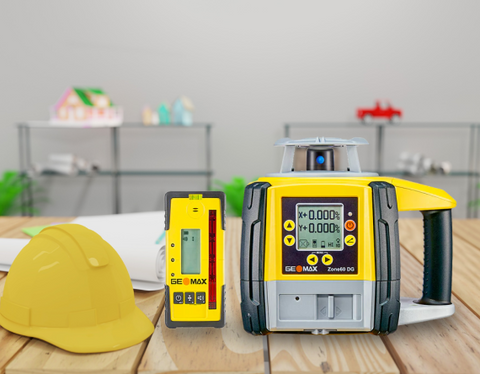
Auto Levels:
Auto levels have a major advantage over traditional hand levels, which you may already be familiar with: a self-leveling system. This internal mechanism eliminates the need for careful manual adjustments with leveling screws by automatically compensating for small tilts in the instrument. On the job site, this leads to quicker setup times and increased productivity.
The land survey equipment you currently have and the auto level work together well. It can be used in conjunction with a grade rod, which is an essential tool for determining the relative heights of points. You can quickly ascertain elevation variations by looking through the auto level's telescope at the graduated staff markings that a partner is holding.
Transit Level:
For particular applications, the transit level continues to be a valuable asset in the toolkit of a contractor. The primary advantage of the transit level is its simplicity, as it lacks the sophisticated electronics and digital displays of more advanced instruments like modern theodolites. In fundamental surveying projects, including but not limited to marking property lines, ascertaining construction site elevations, and transferring levels between points, the transit level provides a reliable and cost-effective solution.
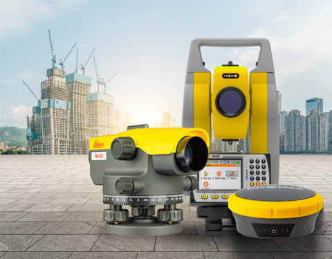
Theodolite:
Theodolites are more complex than levels or transits, but they have better angular measurement capabilities, which makes them perfect for a range of building applications. A tripod-mounted telescope is the main component of a survey theodolite. Because of its capacity to revolve freely on both the horizontal and vertical axes, this telescope can measure angles both horizontally and vertically with extreme accuracy. Theodolites are now often equipped with digital readouts that improve accuracy as well as convenience.
In terms of construction site layout, survey theodolites are indispensable. Contractors can precisely position footings, foundations, and other crucial structural components by measuring and setting exact angles and distances.
Total Station:
Theodolites, electronic distance meters (EDMs), and data collectors are three essential surveying instruments that are combined into one sophisticated electronic device called a total station. Survey theodolites were traditionally used to measure angles, both horizontal and vertical, and EDMs were used to measure distances between points. By integrating these functions, total stations go beyond this and enable the measurement of not just angles and distances, but also the three-dimensional coordinates of specific points in space. Compared to employing separate instruments, total station survey equipment is significantly more efficient due to its comprehensive data collection capability.
Utilizing total station survey equipment has benefits that go beyond straightforward data consolidation. Total station devices are electronic, allowing them to gather and store data digitally, in contrast to conventional surveying techniques. This reduces the possibility of errors and saves a substantial amount of time by doing away with the necessity for manual recording and transcribing. Additionally, onboard software on total stations frequently allows you to make informed decisions on the job site by doing simple calculations and producing real-time results.
Another important advantage of total station survey measurements is their precision. Current total stations are incredibly accurate; they can measure lengths with millimeter accuracy and angles to within seconds of a degree. This high degree of accuracy reduces the possibility of expensive mistakes during construction and results in precise site plans.
Robotic Total Station:
A robotic Total Station differs from a manual Total Station by allowing a single operator to remotely control the instrument, as it can automatically find and track the surveyor's position, eliminating the need for a second person to manually align the instrument with the target.
This remote operation provides contractors with some significant benefits. To begin with, it substantially enhances efficiency. All facets of data collection can now be managed by a single surveyor, eliminating the necessity for an additional individual to handle the prism or reflector. As a result, labor expenses are decreased and project completion times are accelerated.
One of the most notable advantages of robotic total stations is their enhanced precision. The utilization of manual targeting may result in the introduction of human error while collecting data. In contrast, robotic systems utilize automated targeting and data acquisition mechanisms, thereby reducing the likelihood of errors. Precise measurements are of the utmost importance in ensuring accurate construction layout, stakeout, and as-built verification.
Data Collectors:
Robotic Total Stations, and GPS receivers, are just a few examples of the survey equipment that data collectors use. The data collector can receive and record exact measurements of angles and distances when used in conjunction with a total station. It can also record extremely precise coordinates of specific points on your site when it is connected to a GPS receiver.
Data collectors are more than just tools for gathering data. You may perform real-time computations and data analysis right on the site using survey software. This gives your team the ability to make deft decisions in the field and guarantees that tasks are finished according to exact specifications. Furthermore, some data collectors have sophisticated features including the ability to perform digital terrain modeling (DTM), which is a useful visualization tool for intricate projects.
GPS/GNSS:
In today's construction projects, GNSS technology is an essential tool. GPS and GNSS use satellite constellations orbiting the Earth to transmit signals that can be detected by ground-based receivers. These receivers utilize a combination of signal travel time analysis and atmospheric effects compensation to accurately determine your precise location. This high level of accuracy is crucial for various surveying tasks essential to building projects.
For example, GNSS equipment makes it possible to accurately determine property lines and mark out construction sites during boundary surveys. Gone are the days of relying solely on traditional methods like chaining and theodolites. With GNSS, project boundaries may be defined more quickly and accurately while lowering the possibility of mistakes that might cause expensive delays or disagreements.
In topographic surveys, GNSS performs exceptionally well. Detailed digital elevation models (DEMs) that show the current terrain can be created by gathering data points throughout the project site. Planning earthwork projects, creating effective drainage systems, and guaranteeing sound foundation construction all depend on this information. Because GNSS data is accurate, material utilization may be maximized, and rework caused by incorrect site assessments is reduced to a minimum.
(Conclusion)
One can make better decisions by acquiring an understanding of the merits and drawbacks of different types of survey equipment. You ultimately deliver superior results to your clients by ensuring the precision of your data and optimizing the time of your staff through the utilization of the most appropriate tools for each project. This results in enhanced operational processes, decreased project durations, and competitive advantage within the contracting sector.